
Lost Pet Search Assistance
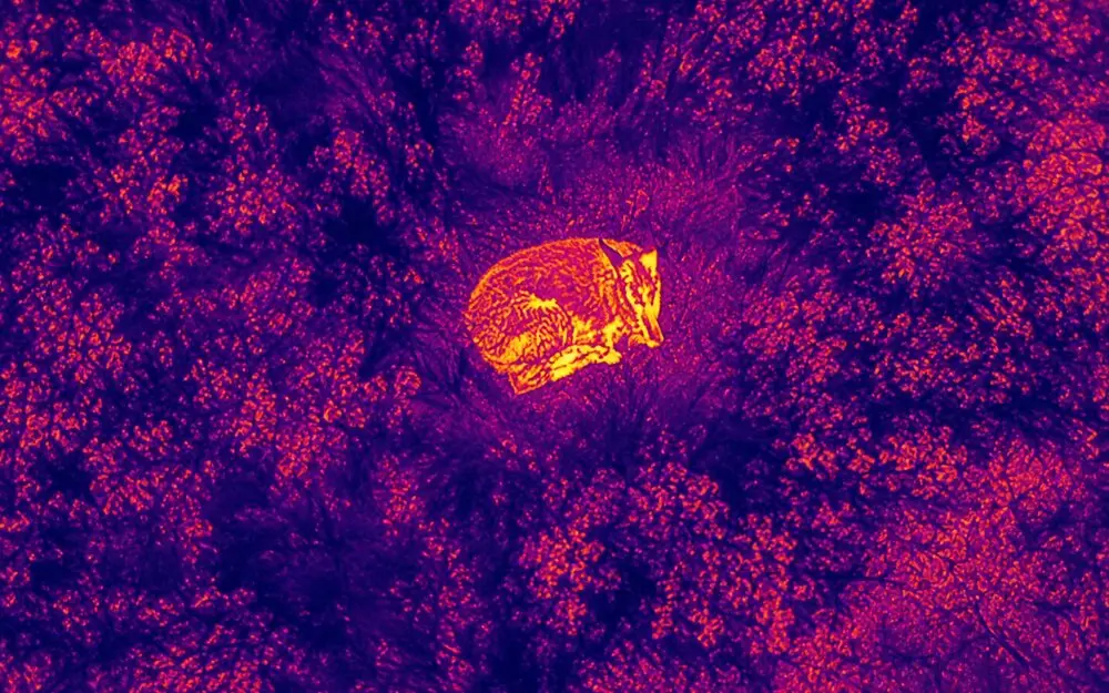
When a pet goes missing, covering a large area quickly can be difficult from the ground. BlueJay uses aerial and thermal imaging to help search fields, wooded edges, brush, open land, and other appropriate areas from above. Thermal imaging can be especially useful when conditions allow an animal's heat signature to stand out from the surrounding environment.
How Aerial Search Can Help
Cover Ground Faster
Larger areas can be viewed far more efficiently from the air than by walking every section on foot.
Reach Hard-to-Access Areas
Aerial imagery can help observe terrain that's difficult or slow to reach on the ground.
Spot Possible Heat Signatures
Thermal imagery may help identify a possible heat signature worth a closer look.
Guide the Ground Search
What's observed from the air can help direct where a ground search focuses next.
A Different Perspective
The drone provides an overhead view when visibility from roads, yards, or trails is limited.
Before We Search
A few details help make a search flight as effective as possible. None of the following is required to reach out — but where available, this information helps:
How the Process Works
Tell Us What Happened
You provide the last known location, recent sightings, and relevant details.
We Evaluate the Area
BlueJay reviews terrain, weather, airspace, access, and whether aerial or thermal imagery is appropriate.
We Search From Above
Visual and/or thermal imagery is used to search appropriate areas.
We Share What We Observe
If a possible target or useful information is observed, it can help direct ground search efforts.
When Thermal Imaging Works Best
Thermal imaging is a genuinely useful tool, but it isn't perfect in every situation. A few things can affect how clearly a heat signature stands out: how warm or cool the surrounding air and ground already are, surfaces that have been heated by direct sunlight, how dense the vegetation or tree cover is, nearby structures, weather conditions, distance from the camera, and the terrain itself. BlueJay factors these conditions into whether — and when — a thermal flight makes sense for your situation.
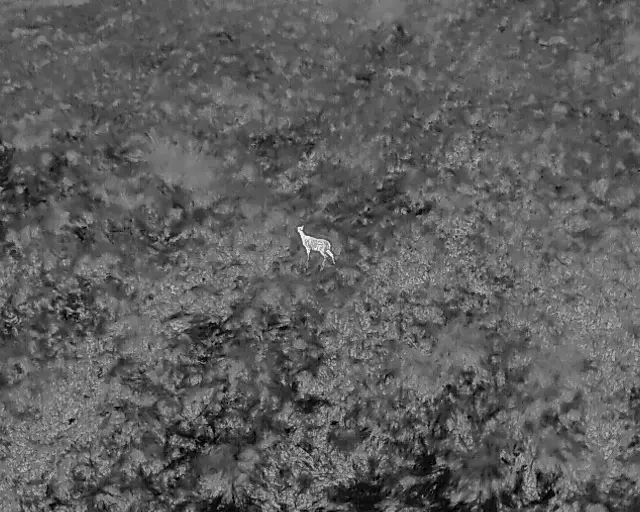
Example of an animal visible in thermal aerial imagery
Common Questions
Can thermal imaging see through trees or buildings?+
No. Thermal cameras detect surface heat — they don't see through solid objects or dense cover the way X-ray or radar might. Thick tree canopy or structures can block or obscure a heat signature.
Is a search guaranteed to find my pet?+
No. Aerial and thermal imaging are search tools that can help cover ground efficiently, but they cannot guarantee that an animal will be located or recovered.
What should I send BlueJay before the search?+
Whatever you have on hand: the last known location, roughly when the animal was last seen, a recent photo, and any distinguishing features or known hiding spots. More detail helps, but none of it is required to get started.
Can you search at night or early morning?+
It depends on conditions — safety, airspace rules, weather, and whether thermal contrast is actually favorable at that time all factor in. We'll talk through timing when you reach out.
Important search limitations: Aerial and thermal imaging are search-assistance tools. Results can be affected by terrain, vegetation, structures, weather, temperature, airspace, and animal movement, and recovery cannot be guaranteed.
Ready to Request This Service?
Tell us the last known location and what you're searching for, and we'll take it from there.